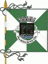
Vila Nova de Foz Côa Municipality (Vila Nova de Foz Côa)
 |
 |
The municipality includes parts in the Côa Valley Archaeological site, declared by UNESCO as a World Heritage Site, which partially shares with Figueira de Castelo Rodrigo and Pinhel also located in the Guarda district.
The closest railway station is Pocinho, now the eastern terminus of the Douro railway line. This line (in Portuguese: Linha do Douro) has passenger trains services from Pocinho to Tua, Peso da Régua, Livração, Marco de Canaveses, Penafiel, Paredes, Ermesinde (for connections to Braga, Guimarães, Viana do Castelo, Rio Tinto and Porto).
Vila Nova de Foz Côa received its first charter in 1299, granted by D. Dinis, having been renewed by the same monarch in 1314. In 1514, a new charter was designed by D. Manuel I. In the county there are several monuments, Among which these three national monuments: the castle of Numão, the Pelourinho of Vila Nova de Foz Côa and the Mother Church of the same village, with a Manueline facade. Another important monument in the county is the castle's best castle shale, a Leonese building dating back to the early 13th century, integrated in the region of Riba Côa, which passed into the hands of the Portuguese crown in 1297 by the Treaty of Alcanizes [5]. ].
In its roots, Vila Nova de Foz Côa meets the Palaeolithic man who, with modest artifacts, in the hardness of the schist he has ambitions and projects of his spiritual and material universe, making this sanctuary the largest museum of outdoor rock art, now Heritage of Humanity.
The vestiges of the human occupation, more or less intense, continue through the times castrejos and Romans. The meager witnesses of the Suevi-Visigothic and Arab periods guarantee, however, the continuity of the population nuclei. Contrary to the vicissitudes proper to the frontier lands at these stops, community life proved regular and continuous, beginning in the tenth century.
The royal and seigniorial interest, in the sense of promoting the settlement and development of this region, was confirmed through the granting of charters to the inhabitants of the settlements, giving them legal and administrative importance. In the 19th century, despite having been a scene of disorders, persecutions and fratricidal struggles (the Marçores guerrilla spread terror in the region) that accompanied the implementation of liberalism, the village of Foz Côa took over the leadership of the county, after several constraints that Justified the substitution or absorption of some municipal offices, namely the multiple administrative reforms of the eighteenth century. Nevertheless, the eight pillars that have survived since then, in the area of the present county, testify to the municipal autonomy and are the symbol of the ancestral community life in the Region.
At the end of the parish of Mós do Douro we found traces of ancient occupation in the places of Campanas and Castelo Velho. They will be small fortified settlements of the Bronze Age, to evaluate by the news of finds that arrived at us.
In contrast to what happens in the north-west of Peninsular, in the region of the hot Douro land, the castro civilization has settled not on top of the mountains but on plateaus or small elevations embedded in valleys. Hence, in the first millennium BC, iron men had settled in the zone of the Castle, a place later Romanized and constituted by a small vico, this being evaluated by the area in which the traces of materials of that period predominate. Graves and a funeral inscription (closing with the common acronyms S.T.T.L. - let the earth be light), among other materials, attest to this occupation.
Other places of the term of Mós must have occupied (in the period of Roman occupation or in the Low or High Middle Ages) cases of Aldeia Velha, place of Fontaínhas (often cited as Fontanas).
Map - Vila Nova de Foz Côa Municipality (Vila Nova de Foz Côa)
Map
Country - Portugal
 |
 |
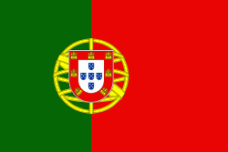
| Flag of Portugal | |
One of the oldest countries in Europe, its territory has been continuously settled, invaded and fought over since prehistoric times. The territory was first inhabited by pre-Roman and Celtic peoples who had contact with Phoenicians, ancient Greeks and Carthaginians. It was later ruled by the Romans, followed by the invasions of Germanic peoples and the Islamic invasion by the Moors, whose rule was eventually expelled during the Reconquista. Founded first as a county of the Kingdom of León in 868, gained its independence as the Kingdom of Portugal with the Treaty of Zamora in 1143.
Currency / Language
| ISO | Currency | Symbol | Significant figures |
|---|---|---|---|
| EUR | Euro | € | 2 |
| ISO | Language |
|---|---|
| PT | Portuguese language |


